Athens
Athens  is the capital of Greece. The city is surrounded by mountains and water.
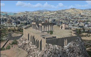
Takeoff from Eleftherios Venizelos Airport (LGAV), officially Athens International Airport, and fly west heading to the top of the high mountain ahead. This gives you a great overview of the city. Fly to the city centre where you will see Acropolis.
The Hellinikon Airport (LGAT) was the city airport until 2001. The airport is still visible in FSX but is in real-life partly demolished today.